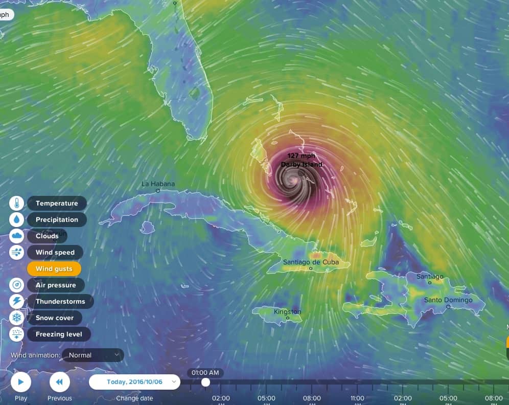
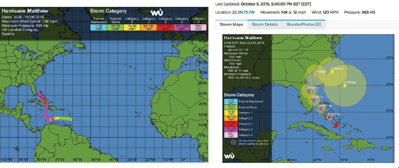
On Oct 5 – 6, 2016 Hurricane Matthew continued a northward path from Cuba and Hispanoila straight up the Exuma chain. Leaving Cuba as a Cat 3 storm, Matthew gradually strengthened to a Cat 4 by the time it reached Nassau. Great Exuma and the Exuma Cays were in the upper right quadrant of the eye wall as the storm passed, with winds exceeding 125 mph.
Darby Island Research Station was shuttered, with no one on site. It was a long night as we monitored wind speeds at Darby and images from the front porch of the lab, emailed by remote cameras. Darby neighbors Marsha and Frank Ellis at Bock Cay, were reporting on Facebook—it was good to hear news from the front lines! With NOAA forecasts indicating potential 10-15 ft storm surge on the west side of the southern Exuma Cays, we were extremely worried that the lab would not survive.
The research station was protected from the strong easts winds but became exposed as the winds shifted to the south about 1 am, as the eye passed just a few miles to the west. 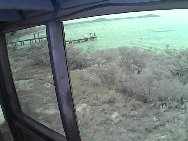 Lab internet stayed up through the night and in the morning our cameras showed that the Darby Island docks were in tact!! We cannot see the Dock House, so will have to wait on first hand reports to know how it fared, but we are extremely grateful that the lab seems to have survived relatively unscathed!
Thanks for all the good wishes and prayers.. We continue to monitor this storm as it marches toward Florida!!
Oct 8